
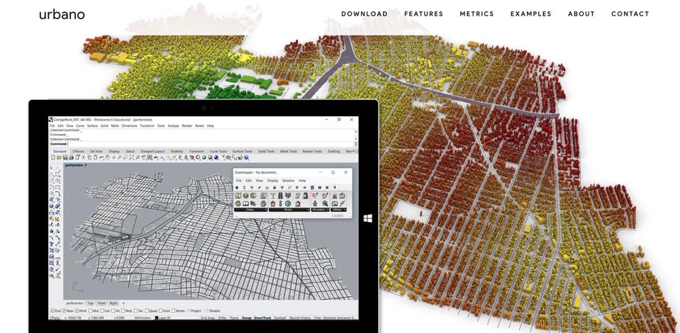
User interface of Urbano, the new free urban planning software recently launched by researchers at … [+]
Cornell University
Ithaca, NY – Researchers at Cornell University recently launched Urbano, a free software that employs data, metrics, and a user-friendly interface to help planners, developers, and architects assess and improve walkability features in their designs.
Architects and planners have traditionally relied on trial-and-error methods, historical data, or specialized simulations when developing walkable neighborhoods. These site analysis techniques can be difficult to accurately incorporate into project planning due to inconsistencies with real-time data.
Timur Dogan, assistant professor of architecture and lead developer of Urbano, created the Urbano software as a way to “allow architects and urban designers to simulate their designs and get feedback early in the process.” Dogan explained that site-specific, real-time data allows those involved in the conceptual phase of a project to “make decisions based on facts and data, so they can create the sustainable and livable urban environments of the future.”

LAKEWOOD, CO -JUNE 17, 2014: Ben Fischer and Michelle Ballew enjoy an outdoor lunch and the … [+]
Denver Post via Getty Images
Urbano relies on three metrics to assess an area’s walkability: Streetscore, which calculates how streets are used for certain routes; Walkscore, a customizable measurement that rates whether popular amenities are within walking distance of homes and workplaces; and AmenityScore, which considers demographics to estimate the usefulness of various services. Such a targeted system is “really helpful information for designers doing site analysis,” according to Dogan, “because they can see if there are certain services or amenities missing in neighborhoods, or others that are underutilized or over utilized.”
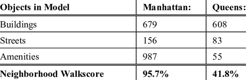
Example of Urbano Walkscore summary.
Timur Dogan
The Urbano model is centered around the goal of developing walkable cities as a viable solution to the negative socio-economic and environmental impacts of traffic congestion, which according to the study’s findings, causes around 3.3 million deaths and $121 billion in economic losses every year.
The Urbano team proposes that assessing walkability in the early phases of a project will allow architects and planners to pivot and viably incorporate pedestrian-friendly features into their designs, since attempting to make such shifts would prove costly and cumbersome once a project is underway.

NEW YORK, NY – JUNE 11: People walk along 97th Street as they pass over the commuter rail corridor … [+]
Getty Images
Since its launch on October 26, 2019, Urbano has been downloaded over 400 times by universities and architecture firms around the world.
The research was partly funded by Cornell’s Center for Transportation, Environment and Community Health, and the Cornell Atkinson Center for Sustainability.
For more information, visit Urbano.